


|
French Ancestors Route |

|
|||
 Once referred to as the French Shore, the French Ancestors Route is a long stretch of coastline where France held fishing and processing rights until 1904. The French Ancestors Route begins in the community of Kippens and encompasses the entire Port au Port Peninsula. After traveling through the community of Port au Port East, Route 460 crosses a tiny isthmus, often referred to as The Gravels. The Gravels Rest Stop boasts eight kilometers of walking trails, story boards and a picnic area. On June 20th, 2004, the Worldwide Peace Marker Project (WPMP) placed the Canadian Peace Marker at the Gravels Rest Stop, designating it Point of Peace #4 on earth. This is the only Peace Marker in all of Canada.
In Port au Port West, tour Our Lady of Mercy Church which was built in 1914. It stands proudly as a testament to the work and dedication of the early settlers of the Port au Port area. Built by the local community, the architecture showcases the skills of the builders who were fishermen, farmers and miners. The interior of the church has a ceiling shaped like the hull of a boat. This church was designated a provincial historic structure in 1996. Continuing on Route 460 there are cliffs of sedimentary rock along the oceans edge as well as several fishing communities. Explore the three French-speaking communities Cap Saint-Georges (Cape St. George), La Grand Terre (Mainland) and IAnse-a-Canards (Black Duck Brook). For more information on local accommodations, restaurants, events, attractions and more please review the French Ancestors Route Database. 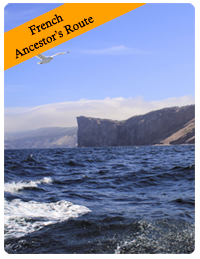
|
||||